 Live Music Archive
 Librivox Free Audio
 Metropolitan Museum
 Cleveland Museum of Art
 Internet Arcade
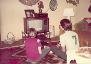 Console Living Room
 Books to Borrow
 Open Library
 TV News
 Understanding 9/11
View Post [edit]
| Poster: | marc tuters | Date: | Aug 7, 2004 6:48am |
| Forum: | bookmobile | Subject: | map mobile |
MC3: Mobile Cartographic Command Center
In 2004 and 2005 the Mobile Cartographic Command Center (MC3) will be touring Canadian cities providing an opportunity to educate and build networks among students, artists, members of the public, geographical institutions and media art groups. The MC3 exists to focus attention on a diverse yet related group of concepts, including locative media, the wireless commons, free and open source GIS, civil surveillance, and enviornmental and social issues.
Locative Media
With the advent of the mobile phone as an interface to the Internet, and ever increasing popularity of location technologies such as the Global Positioning System (GPS), artists are conceiving of urban space as the interface to digital media. This has generated a substantial new discourse in the new media arts and grassroots technology developers community, propagated, to some extent, by workshops organized by the Locative Media Lab at events such as O'reilley's ETCON, Next 5 Minutes, Transmediale, the VSMM's Hybrid Realities conference VSMM, and Futuresonic, as well as in Latvia, Finland, France, Norway, Iceland and Slovenia. The MC3 will create original locative media installations at the sites that it visits, as well as showcasing the work of local "locative" artists and showcasing freely available locative media tools.
Wireless Digital Commons
New advances in wireless internet technology are changing not only how people connect to the internet but also how they approach the wireless spectrum itself. Wireless internet access points are popping up all over Canadian cities, established by individuals, free-wireless community activists, and enterprising businesses. Other wireless modes include mobile phone network access for voice and data, but also the rest of the radio spectrum including FM radio. Ideas of use and ownership are being analyzed and reconsidered in this environment. The MC3 will help the public understand some of these issues by exploring the radio spectrum and mapping out how it is used across Canada and in local areas. This includes mapping and visualizing wi-fi access points, both public and private (wardriving), exploring the mobile phone networks, FM radio networks, and discussing new wireless technologies on the horizon.
Free & Open Source GIS
The Canadian public as well as the citizens of other countries have been for many years accumulating data about their national territories as well as the earth and earth systems. Only recently, however, has this data begun to be made publically available and also technologically accessable by individuals and organizations. Natural Resources Canada's Atlas of Canada and Geogratis are excellent examples of the potential of publically accessable GIS data.
While more and improved access to public GIS data is still needed, as well as more development on open GIS tools, the other important issue is connecting the public with these geographical information resources, and re-connecting the public with their country and their world. The MC3 will help in this area, while exploring the state of the art in free and open GIS today.
Civil Surveillance
With recent advances in mobile wireless technology, including the internet, and wi-fi, but also consumer devices like cameras mobile phones, and even consumer-available unmanned aerial surveillance vehicles, civil society at last obtains the information advantage enjoyed by the secret services, the army or the police. This changes public affairs in many ways, for individuals, grassroots citizen organizations, and demonstration crowds that effect our understanding of the public and private spheres. Citizen organizations can collaboratively monitor corporate state of affairs for corruption. Demonstration crowds can organize with tools similar to the state. Everyone can watch everyone else with equal opportunity. The MC3 will explore some of these issues with hands-on examples of civil surveillance.
Environmental and Social Issues
Maps tell stories, and one of the greatest potentials of maps and newly accessable mapping technology is that by listening to the stories maps have to tell, the public can come to understand more about the country and the world in which we live. At a time when greater attention is being focused on issues of climate change and politcal change in Canada and around the world, cartography has the potential to focus that attention where it is needed the most, and to catalyze that attention into action. The MC3 will use cartography to educate and increase awareness in the public about these issues.
Hardware and Software Systems
The MC3 will employ and showcase a number of different technologies that include Canadian and international innovations in free and open-source software.
more information on MC3 systems
Schedule
The initial phase of the MC3 project involves touring major Canadian cities as part of the Mobile Digital Commons Network (MDCN) initiative. This schedule will focus on the cities hosting MCDN member groups, and includes Vancouver, Banff, Toronto and Montreal, and Fredricton.
Further schedules will include other cities and regions of Canada as well as the USA.
Sponsors and Participants
This initiative is funded and supported by the Locative Media Lab, the Mobile Digital Commons Network (MDCN), Concordia University, the Banff Center, and the Pandora Benevolent Society.
